June 12 thru June 23
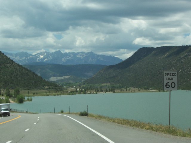
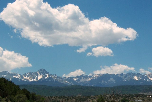
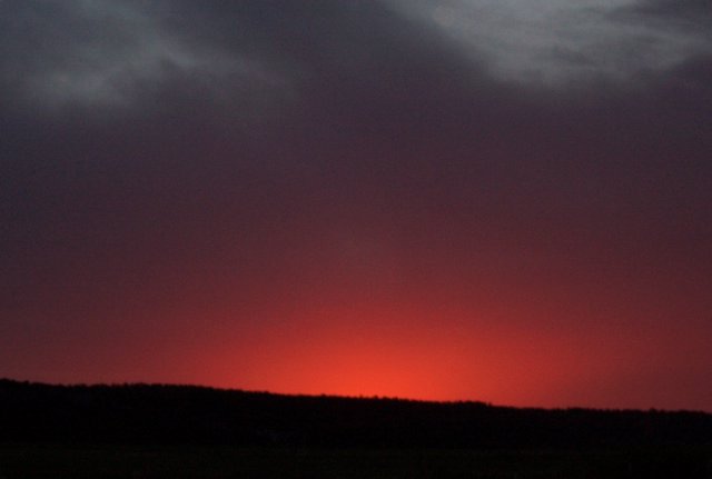
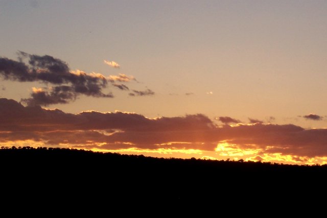
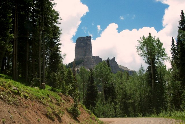
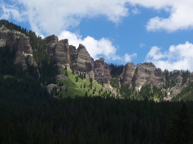
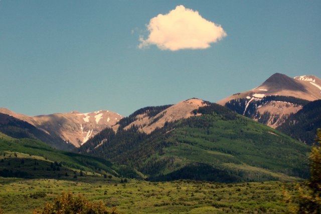
Our trip to Montrose, Colorado took us along I 70 to Grand Junction and then south on Highway 50. This area is not scenic like we saw on I-70 West of Moab. As we approached Montrose we begin to see the San Juan Mountains in the south and the Uncompahgre Mountains in the East. The snow is still pretty heavy on the San Juan Mountains. We are located in an RV park south of Montrose with beautiful views of the mountains and gorgeous sunsets every night when there are clouds in the sky.
Friday, June 23, 2006


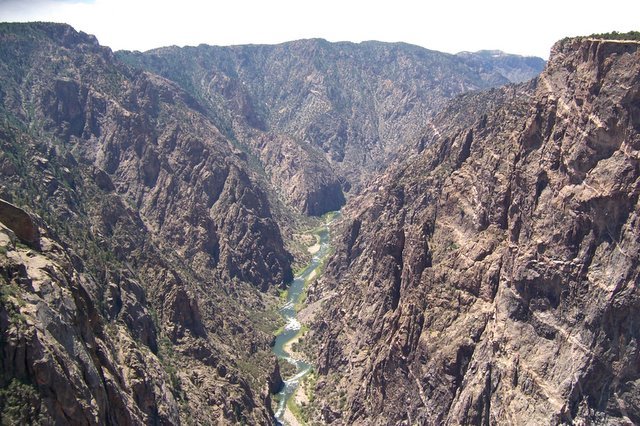
Our next excursion took us to the beautiful Black Canyon of the Gunnison National Park, one of the most spectacular areas in Colorado. This canyon has been a barrier to humans from the time it was formed. Only its rim, never the gorge, show evidence of human occupation—not even by Ute Indians living in the area since written history began. There were some expeditions in the 1800’s but it was deemed inaccessible. The Gunnison River drops an average of 96 feet per mile in its 48 miles in the National Park. Some water from the river now is diverted to a dam used for irrigation here in the valley. Undammed, the river used to slam through this gorge in flood stage at 12,000 cubic feet per second with dramatic force scouring the riverbed and eroding canyon walls. At one point the gorge is 2,772 feet deep. It is an awesome site.


Friday, June 09, 2006
Friday night we went to Bar M Chuchwagon. This was similar to the Prairie Rose Chuckwagon near El Dorado, Ks which we went to a few years ago with some of our bike friends from Manhattan. A nice dinner is served cowboy style and after we were entertained by a good cowboy singing band and comedy. We had a good time and the food was very tasty. We have seen Chuckwagons similar to this in several towns we have been in. So far, the one in Kansas is the best.
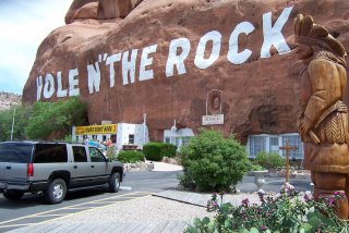
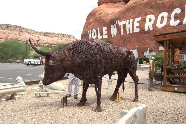
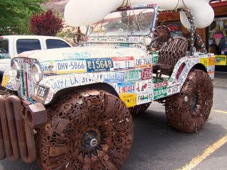
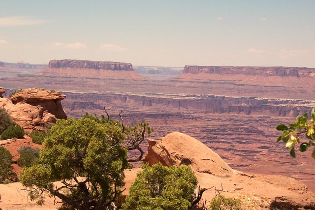
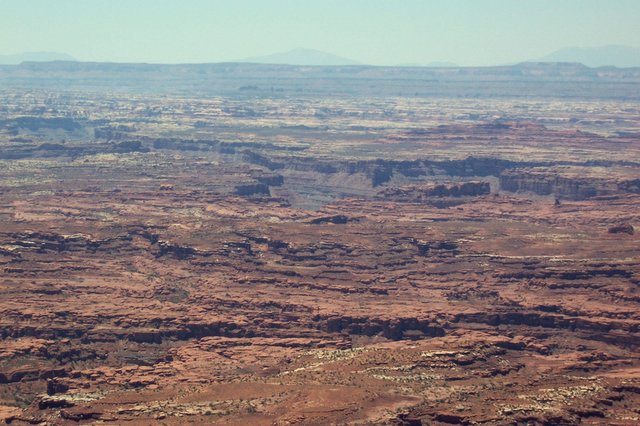
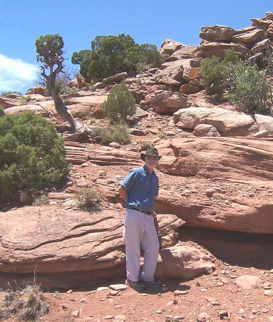
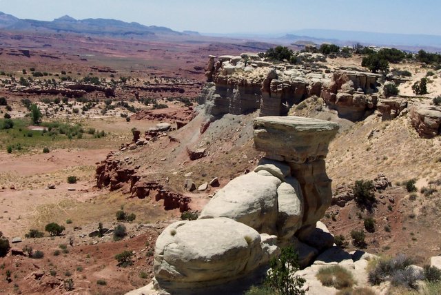
Saturday we drove south to see part of the Canyonlands National Park. It is a very big area and can only be seen from a few spots. We chose to go to the Needles Overlook which is about 60 miles south of Moab. Along the way we stopped at a commercial tourism spot called Hole N’ The Rock. Sometime about 50 years ago a man decided to make a home in the limestone rock. It has, I think, 8 rooms in it and he and his family lived there. Now it is open to the public for a tour. We did not take the tour but did enjoy some of the other “calling cards” there.
Saturday we drove south to see part of the Canyonlands National Park. It is a very big area and can only be seen from a few spots. We chose to go to the Needles Overlook which is about 60 miles south of Moab. Along the way we stopped at a commercial tourism spot called Hole N’ The Rock. Sometime about 50 years ago a man decided to make a home in the limestone rock. It has, I think, 8 rooms in it and he and his family lived there. Now it is open to the public for a tour. We did not take the tour but did enjoy some of the other “calling cards” there.
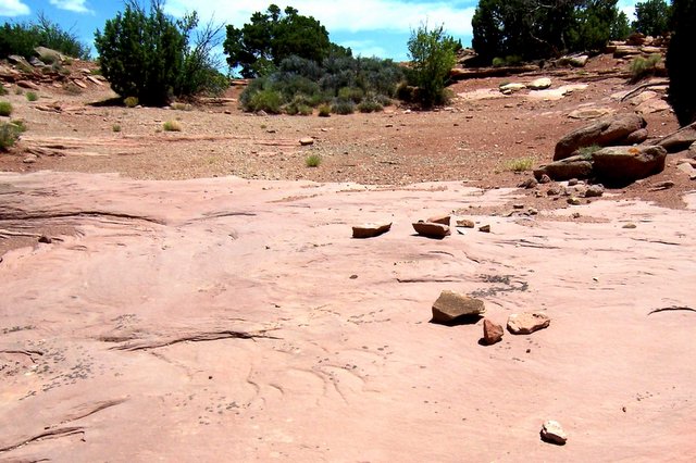
Moab is a Mecca for bicyclist. There are many difficult trails but one I found most interesting, and that calls many bikers to the area is called the Slick Rock Trail. Many of the plateaus are solid rock which are somewhat smooth but not necessarily level. It is a great sport here. This picture is a small area but an example of the rock they bike on.
Wednesday, June 07, 2006
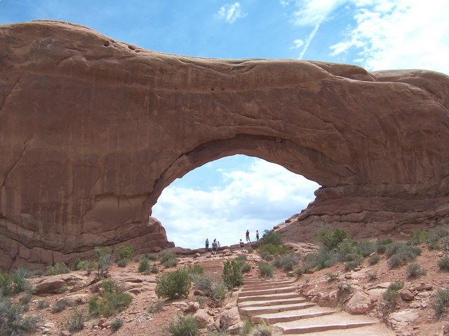
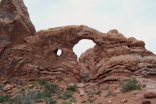
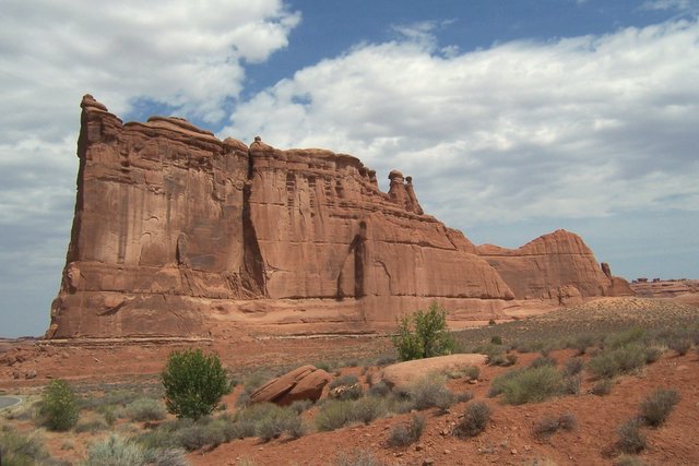
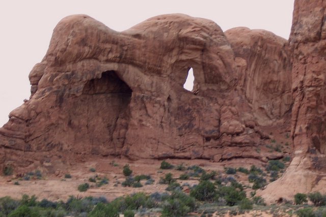
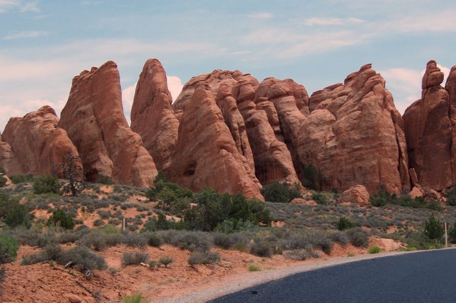
Thursday we went to Arches National Park. The various rock formations along with the upheaval and water erosion have produced such magnificent displays. More than 2000 arches are on display in the park but most of them are accessible by 4X4 vehicles and or complicated trails only. We did hike to several as most were not visible from the main road. God’s glory is displayed here in this park. It was a partly cloudy day so the temps were nice. Enjoy these pictures…they make nice desktops for your computer. (right click on the desktop and choose “set as desktop)

Monday, June 05, 2006
June 5
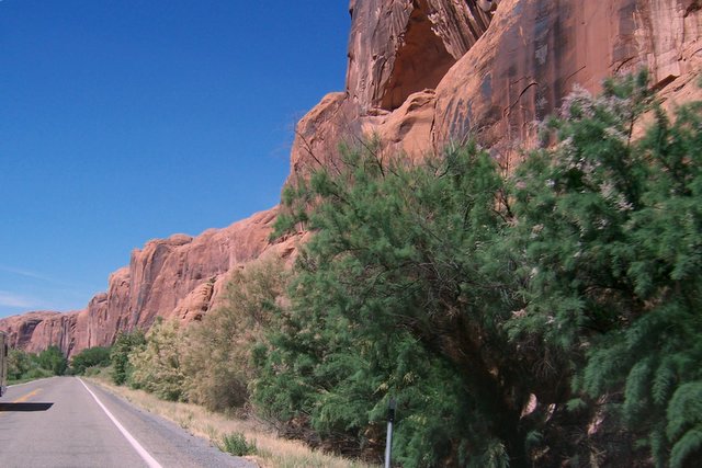
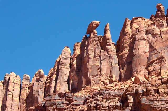
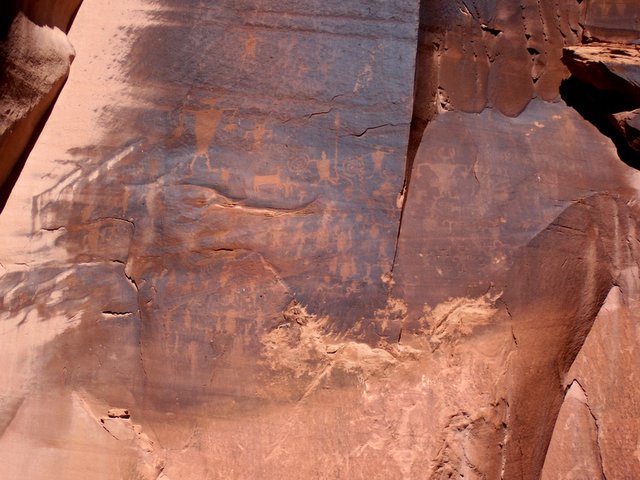
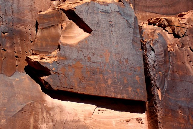
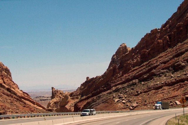
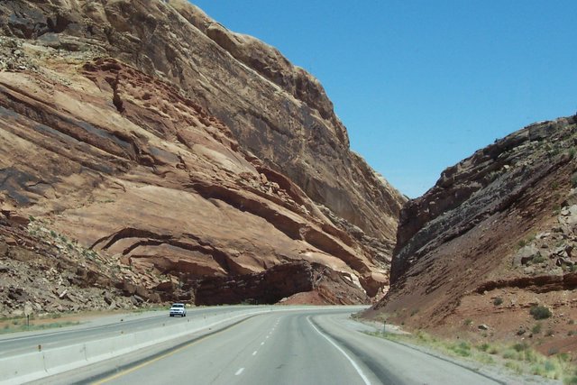
We are in Moab, Utah. The heat is back on!! It is close to 100 every day some days hotter here. We had thought it would be a higher elevation, thus cooler. On Tuesday June 6 we drove through some scenic roads in the area. One drive was along the huge bluffs that are on both the east and west sides of Moab. This rock is mainly very red sandstone. Some of the bluffs are solid rock with no soil at all. We saw petrogliphs etched in these flat walls. They are quite impressive. As we drove east of Moab the bluffs broke up into mountainous towers. As we kept climbing we found ourselves in the LaSal Mountains which are covered with pines and cedars. It is a much higher elevation and so much cooler.
We are in Moab, Utah. The heat is back on!! It is close to 100 every day some days hotter here. We had thought it would be a higher elevation, thus cooler. On Tuesday June 6 we drove through some scenic roads in the area. One drive was along the huge bluffs that are on both the east and west sides of Moab. This rock is mainly very red sandstone. Some of the bluffs are solid rock with no soil at all. We saw petrogliphs etched in these flat walls. They are quite impressive. As we drove east of Moab the bluffs broke up into mountainous towers. As we kept climbing we found ourselves in the LaSal Mountains which are covered with pines and cedars. It is a much higher elevation and so much cooler.
Sunday, June 04, 2006
Thursday, June 01, 2006
June 1, 2006
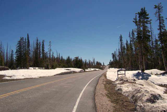
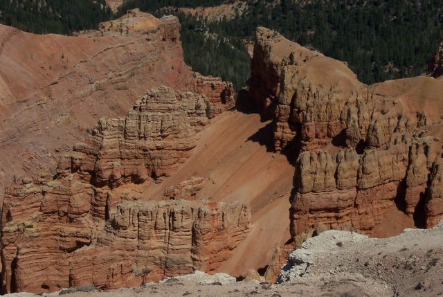
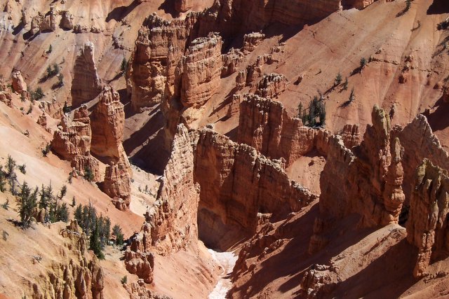
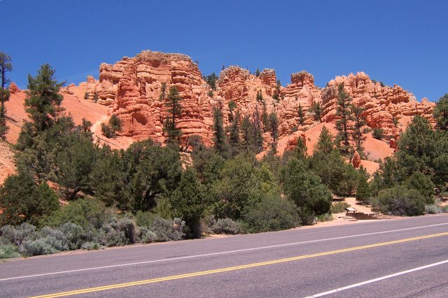
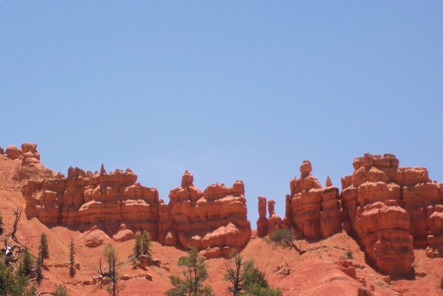
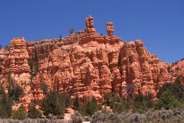
We drove to Bryce Canyon and along the way went through an area called Cedar Breaks National Monument. The Indians gave it this name for the Cedar and Pine trees. Breaks is another name for Bad Lands. It too was very beautiful. We were up to 10,400 feet at one point and there was snow that we had to walk through to get to the viewing points. It is beautiful and just a taste of what is to come in Bryce Canyon.
We drove to Bryce Canyon and along the way went through an area called Cedar Breaks National Monument. The Indians gave it this name for the Cedar and Pine trees. Breaks is another name for Bad Lands. It too was very beautiful. We were up to 10,400 feet at one point and there was snow that we had to walk through to get to the viewing points. It is beautiful and just a taste of what is to come in Bryce Canyon.
Subscribe to:
Posts (Atom)
